Hours, prices and access verified by the Fiordland Tours team — last checked 2026-09-21.
Mitre Peak rises 1,692 m straight out of Milford Sound, and DOC calls it one
of the most photographed peaks in the world. You see it from the foreshore, from every boat on
the fiord and from the small planes that land beneath it. This is where the name comes from,
where to stand, and who first reached the top. If you are comparing
Fiordland National Park tours, every Milford day includes it.
1,692 metres straight from the water
Fact
Figure
Source
Height
1,692 m, rising straight from the water
DOC
Where
The south shore of Milford Sound
Te Ara
Māori name
Rahotu
Visit Fiordland
Why ‘Mitre’
Its shape from the south, like a bishop's mitre
Te Ara
Named by
Probably the survey ship HMS Acheron, in 1851
Te Ara
The summit
Five closely grouped individual peaks
Te Ara
Best view on foot
The foreshore walk at the head of the fiord
DOC
Most mountains rise from foothills. Mitre Peak rises from sea level: the fiord at its foot
is salt water, and the summit is 1,692 m above it. That is why it looks so tall from the
deck of a boat. Te Ara adds a detail: the summit is five closely grouped peaks, not one
point.
Rahotu, and a bishop's mitre
Visit Fiordland gives the Māori name as Rahotu. The English name is about shape. Seen from
the south, the peak looks like a bishop's mitre, the tall pointed head-dress. Te Ara's 1966
encyclopaedia says the name was probably given by the survey ship HMS Acheron in 1851.
The view that fixed the name is the one you get from the head of the fiord, where the
terminal and the lodge stand. Te Ara notes that this view "has been publicised in many
illustrations and posters". You will know it the moment you see it.
The classic view from the foreshore walk
Start at the lodge: the walk runs along the foreshore at the head of
Milford Sound, past the airport.
Walk towards the terminal: it takes up to 30 minutes.
Look across the water: the peak stands on the far shore, with the fiord
in front of it.
DOC names this as the best place to see Mitre Peak on foot. It suits a morning before your
cruise, or the wait after it. If you drive in, you park, walk to the terminal and can do the
foreshore in the same trip.
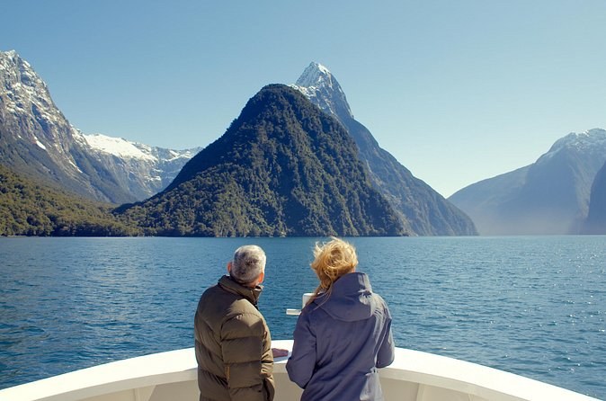
Two passengers at the bow of a cruise boat, facing a pointed peak across the fiord
Under it on the water
How you see it
From where
What you get
A day cruise from the terminal
Milford Sound Visitor Terminal
1 hour 45 minutes to 2 hours, past the peak on the way out
A coach day with a cruise
Te Anau or Queenstown
The same cruise, after the drive in
An overnight boat
Milford Sound Visitor Terminal
The peak at dusk and again after breakfast
A fly-cruise-fly day
Queenstown
A landing beneath the peak, then the cruise
On foot
The lodge at the head of the fiord
Up to 30 minutes on the foreshore walk
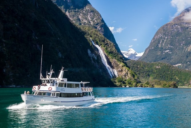
You cannot sail Milford Sound without passing Mitre Peak, because it stands on the south
shore near the head of the fiord. The day boats pass it on the way out, and the 2-hour boats
go on past Lady Bowen Falls and out to the Tasman Sea. What you choose is how you get to the
boat: by car, by coach or by plane. Compare the options on
the Milford Sound tours page.
Over it by air
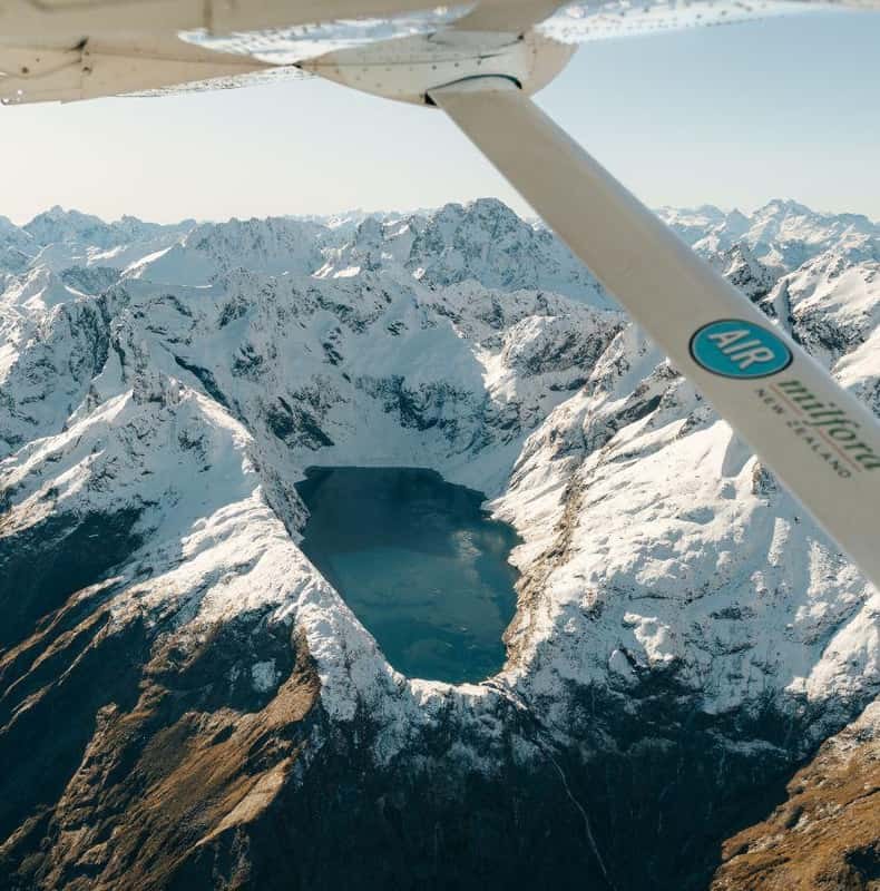
The small planes from Queenstown fly over the mountains and land at Milford Sound, and one
listing describes the landing as beneath Mitre Peak. The flights take 30 to 40 minutes each
way. The fly-cruise-fly days return on a different route, so you see new country on the way
home.
The flight is also the part of the day that weather can stop. A flight cancelled for
weather is rebooked or refunded, and on the coach-in, fly-back day you ride the coach home
with part of the fare back. The flights here are fixed-wing planes.
The first climb, and whether you can
Jim Dennistoun made the first recorded ascent. His own account, reprinted in To The
Mountains, says he rowed from Sutherland's across to Sinbad's Gully with a track porter named
Joe, and started climbing at 7.30 in the morning. The account dates it Monday, 13 March 1910;
most histories give 1911.
The porter stopped at about 4,200 feet. Dennistoun went on alone, took off his boots, and
crossed the last smooth granite slabs in rubber sandshoes. He reached the summit at 1.15 in
the afternoon and left a handkerchief in a small cairn. Te Ara says the best access to the
summit is by the western slopes from Sinbad Valley.
So yes, it can be climbed, but only as a mountaineering route. No tour here climbs it.
Light, weather and the photograph
Milford Sound takes up to 7 m of rain a year, so plan for cloud on the peak and treat a
clear view as luck. Rain has its own reward. Visit Fiordland says the fiord is particularly
dramatic on rainy days, with mist and waterfalls on full display.
Summer gives you long days, from about 5:30 am to 9:30 pm. Winter is the most settled
season, Visit Fiordland says, and often blue and cloudless, but the light is short. On an
overnight boat you see the peak at dusk and again in the morning. Month by month, the detail
is on the Fiordland weather page.
Questions about Mitre Peak
How tall is Mitre Peak?
1,692 m, rising straight from the water, DOC says. The classic view is from the Milford Sound Foreshore Walk near the terminal.
Why is it called Mitre Peak?
Seen from the south, its shape looks like a bishop's mitre, the tall pointed head-dress. Te Ara says the name was probably given by the survey ship HMS Acheron in 1851.
What is the Māori name for Mitre Peak?
Visit Fiordland gives the name Rahotu. It writes the peak as Rahotu / Mitre Peak.
Can you climb Mitre Peak?
It has been climbed, but it is a mountaineering route, not a walk. Its first climber needed a rope, soft-soled shoes for the granite slabs and most of a day.
Where is the best view of Mitre Peak?
DOC points you to the foreshore walk at the head of Milford Sound, up to 30 minutes from the lodge to the terminal. From the water, every Milford cruise passes beneath it.
Where these facts come from
The height and the foreshore walk are the Department of Conservation's, checked 21 September 2026. The
name Rahotu is Visit Fiordland's. The naming, the grouped summit and the western route are
from Te Ara's 1966 encyclopaedia entry. The first ascent is Dennistoun's own account. What
each tour passes comes from its own listing.
One hour 45 minutes from the Milford terminal on a boat that sails about half full, with coffee, tea and biscuits. No food is sold, so bring your own; wheelchairs and strollers can board.
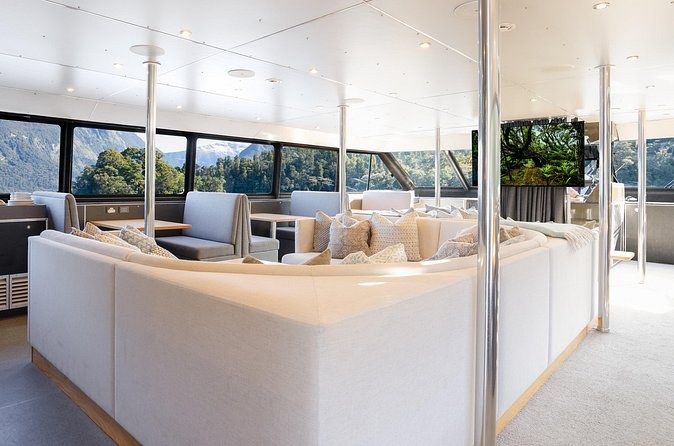
A night at anchor on the fiord: dinner, the top-deck hot tub, kayaks and a tender-boat trip, an ensuite cabin and breakfast. Adults book in pairs, and the fare is non-refundable.